Overture Maps - Fused-partitioned
The Overture 2024-12-18.0 dataset, geo-partitioned with Fused for convenient access.Overture - Fused-partitioned
Overview
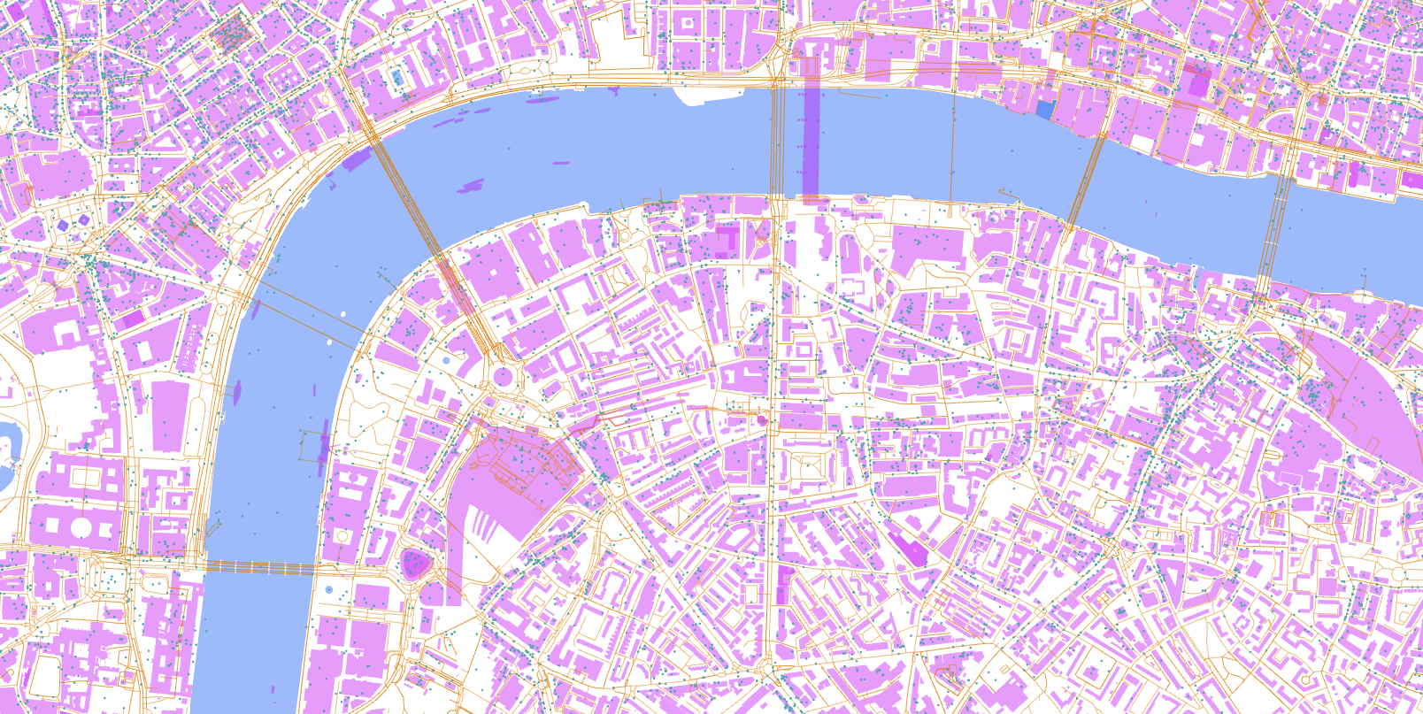
This is the Overture dataset, geo-partitioned with Fused for convenient access. This dataset adheres to the Overture Data Schema.
Quickstart
Access to this dataset is facilitated by the Fused platform. Browse the data on Fused Workbench.
To access using Python, the Overture Maps Example UDF shows an example of how to access the data using Fused:
You can query the data visually using our notebook.
Partitioning
This dataset is geospatially partitioned following Open GeoParquet standards, using Fused.
For technical reasons, the release is named 2024-11-13-0 in S3 (note the dash instead of a period at the end).
Under each release, the data is divided into themes: admins, base, buildings, places, and transportation. Each theme contains one or more tables, which is a collection of GeoParquet files (0.parquet, 1.parquet, etc.), Parquet metadata (_metadata), and Parquet sample (_sample).
The older release, 2024-03-12-alpha-0, has the following themes:
theme=admins/type=administrative_boundary/- Administrative boundaries such as country borderstheme=base/type=land_use/- Land usetheme=base/type=water/- Water boundariestheme=buildings/type=building/- Building footprints. Because of the size of this table, it is further subdivided into multiple parts. There is no semantic meaning to these parts, they are subdivisions to help partitioning.theme=buildings/type=building/part=0/theme=buildings/type=building/part=1/theme=buildings/type=building/part=2/theme=buildings/type=building/part=3/theme=buildings/type=building/part=4/
theme=places/type=place/- Places (POIs) such as restaurants and other businesses.theme=transportation/type=connector/- Points where transportation segments, below, are connected.theme=transportation/type=segment/- Line strings of how human movement is organized, such as roads and walkways.
There are older releases, 2024-03-12-alpha-0 and 2024-02-15-alpha-0 that have slightly different folder structures, where types are named in camel-case. (E.g. administrativeBoundary, landUse.)
Original dataset
The original Overture datasets are downloadable from the Overture website. See the Overture GitHub repo for more information.